 Mohawk Lakes - Breckenridge, CO
Difficulty: Moderate
Elevation Gain: 2,129 feet
Located off US Highway 9 and Spruce Creek Road just past the town of Breckenridge, the Mohawk Lakes Trail offers just about everything there is to see on a rocky mountain hike. This 8.6 mile out and back trail is best used from July to October. I suggest parking at the Spruce Creek Trailhead and following that to the Mohawk Lakes trail intersection about 2 miles in. The hike starts right along the Spruce Creek which provides serene sounds as you walk through the forested trail surrounded by pines and boulders. The first pond is about a mile into the hike, step off the trail to see the pond reflecting beautiful views of Crystal and Pacific peaks. About 3 miles in old mining cabins can be seen and explored. The terrain begins to get a bit rocky here so watch your steps carefully! Right past the cabins stunning waterfalls roar, make sure to check them out before continuing on to the lakes! Another half mile or so past the waterfalls is lower Mohawk Lake, you may think you've seen it all when you reach lower Mohawk Lake, but if you have the energy to keep going Mohawk Lake along with a series of other beautiful lakes are past the ridge above Lower Mohawk. The last part is quite difficult to get to the second set of lakes but is definitely worth it to see crystal blue high alpine lakes. Various fish inhabit these lakes and can easily be spotted from the shore. Wildflowers bloom along this trail from July to September and moose are commonly spotted. Rivers, waterfalls, lakes, cabins, wildlife and astounding views are all included in this hike which makes it a must do while in Summit County. Stop and get some well deserved lunch in Breckenridge after completing this awesome hike.
Buffalo Cabin Trailhead, Silverthorne, CO
Difficulty: Hard
Elevation Gain: 3,018 feet
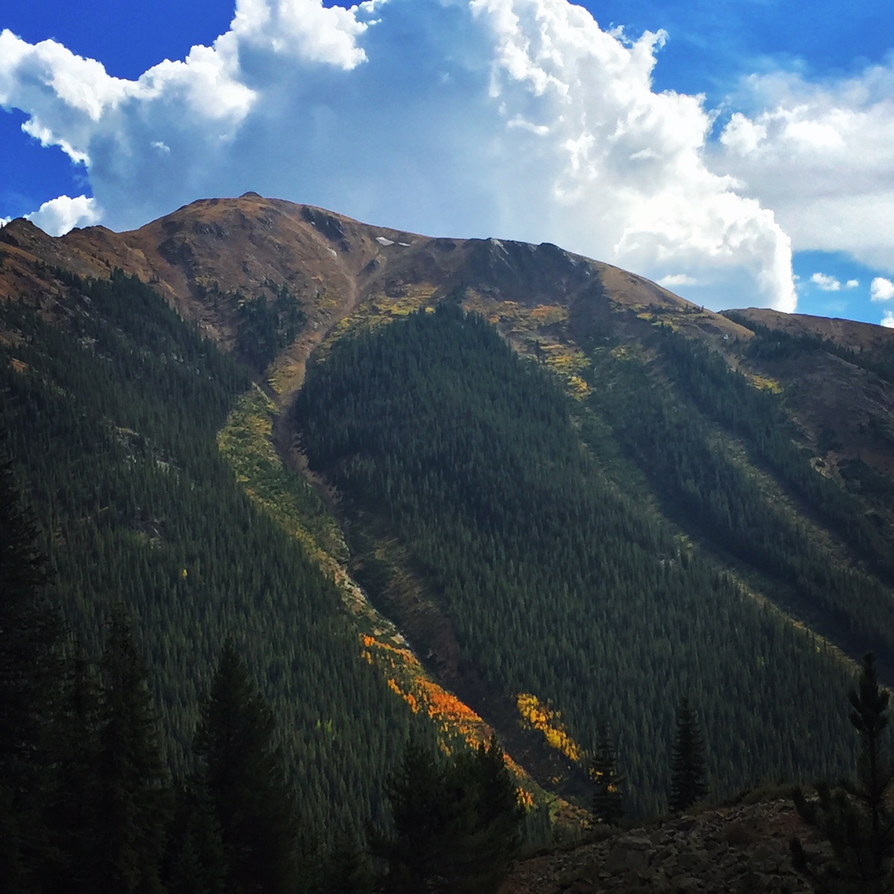
The trailhead is located at the top of Ryan Gulch Rd in Silverthorne, parking can fill up quickly on weekends, and it is best to start early to avoid getting stuck in any afternoon showers. This 5.2 mile out and back trail is a gorgeous forested trail which is pretty moderate until you get out of treeline. The trail is best used July to October. There is a lot of elevation gain in a short amount of time so make so you have a good amount of water and go at a comfortable pace. When reaching the boulder field right out of treeline keep an eye out for mountain goats that inhabit this area, they are typically friendly but always keep a good distance and never feed wildlife! Climbing over the boulder field easily takes an hour and can be intense at times, where hands and feet climbing is necessary. You can often see marmots sunbathing in the rocks - you will hear their squeaks too! Be careful and use caution when on this part of the trail. Use the cairns ( vertical stacks of rocks) to guide you and ensure you are on the correct path. Once past the boulder field there is another mile of uphill hiking until you are at the top of Buffalo Mountain at 12,971 feet high. The views at the top of Buffalo make it one of the best hikes because you can see Summit County in its entirety! Views of Copper Mountain, Breckenridge, Frisco, Keystone, Dillon, and Silverthorne as well as the gorgeous Red Mountain and Gore Range can be taken in while enjoying a snack at the top. The hard work is well worth the breaktaking views and knowing that you summited the most distinguishable mountain in Summit County is quite rewarding!
Happy Hiking!
Mohawk Lakes - Breckenridge, CO
Difficulty: Moderate
Elevation Gain: 2,129 feet
Located off US Highway 9 and Spruce Creek Road just past the town of Breckenridge, the Mohawk Lakes Trail offers just about everything there is to see on a rocky mountain hike. This 8.6 mile out and back trail is best used from July to October. I suggest parking at the Spruce Creek Trailhead and following that to the Mohawk Lakes trail intersection about 2 miles in. The hike starts right along the Spruce Creek which provides serene sounds as you walk through the forested trail surrounded by pines and boulders. The first pond is about a mile into the hike, step off the trail to see the pond reflecting beautiful views of Crystal and Pacific peaks. About 3 miles in old mining cabins can be seen and explored. The terrain begins to get a bit rocky here so watch your steps carefully! Right past the cabins stunning waterfalls roar, make sure to check them out before continuing on to the lakes! Another half mile or so past the waterfalls is lower Mohawk Lake, you may think you've seen it all when you reach lower Mohawk Lake, but if you have the energy to keep going Mohawk Lake along with a series of other beautiful lakes are past the ridge above Lower Mohawk. The last part is quite difficult to get to the second set of lakes but is definitely worth it to see crystal blue high alpine lakes. Various fish inhabit these lakes and can easily be spotted from the shore. Wildflowers bloom along this trail from July to September and moose are commonly spotted. Rivers, waterfalls, lakes, cabins, wildlife and astounding views are all included in this hike which makes it a must do while in Summit County. Stop and get some well deserved lunch in Breckenridge after completing this awesome hike.
Buffalo Cabin Trailhead, Silverthorne, CO
Difficulty: Hard
Elevation Gain: 3,018 feet
The trailhead is located at the top of Ryan Gulch Rd in Silverthorne, parking can fill up quickly on weekends, and it is best to start early to avoid getting stuck in any afternoon showers. This 5.2 mile out and back trail is a gorgeous forested trail which is pretty moderate until you get out of treeline. The trail is best used July to October. There is a lot of elevation gain in a short amount of time so make so you have a good amount of water and go at a comfortable pace. When reaching the boulder field right out of treeline keep an eye out for mountain goats that inhabit this area, they are typically friendly but always keep a good distance and never feed wildlife! Climbing over the boulder field easily takes an hour and can be intense at times, where hands and feet climbing is necessary. You can often see marmots sunbathing in the rocks - you will hear their squeaks too! Be careful and use caution when on this part of the trail. Use the cairns ( vertical stacks of rocks) to guide you and ensure you are on the correct path. Once past the boulder field there is another mile of uphill hiking until you are at the top of Buffalo Mountain at 12,971 feet high. The views at the top of Buffalo make it one of the best hikes because you can see Summit County in its entirety! Views of Copper Mountain, Breckenridge, Frisco, Keystone, Dillon, and Silverthorne as well as the gorgeous Red Mountain and Gore Range can be taken in while enjoying a snack at the top. The hard work is well worth the breaktaking views and knowing that you summited the most distinguishable mountain in Summit County is quite rewarding!
Happy Hiking!
Posted on 4/27/2018 by Alyssa Hubbard
5 Summit County Summer Hikes For Your Keystone Vacation
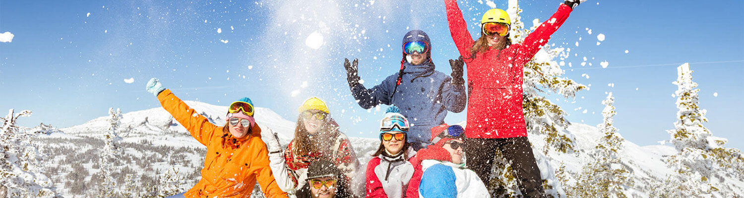
Summer in Keystone and Summit County, Colorado means gearing up and getting out in the sun! With an abundance of trails, getting exercise in nature is as convenient as it is fun. Listed here are some of the best hikes you can do while visiting Keystone on your summer vacation. With various difficulties, use this list to help you choose, if you are overwhelmed by the seemingly endless options of trails and routes!
North Ten Mile Creek Trailhead - Frisco,CO
Difficulty: Easy
Elevation Gain: 872 feet
This out-and-back trail is awesome for the whole family. The trailhead is easily accessible, right off I-70 Exit 201, there is small parking lot for the trailhead with additional parking on the other side of I-70, closer to the town of Frisco. The full trail runs about 6.6 miles which can take up to 4 hours, so make sure to pack snacks, sunscreen, and wear comfortable hiking shoes if you plan to do the entire trail. One of the best things about this hike is that you can only hike a mile in and still enjoy the beautiful views of the Ten Mile Canyon and the rushing creek. Wild flowers bloom from June to August and there are several small waterfalls that can be easily seen if you take a few steps off the main trail. If you are looking for a longer hike or backpacking expedition this trail connects to the Gore Range Trail that extends around 41 miles and ends in Kremmling, Colorado. You may see some backpackers on North Ten Mile trail as this connection is a popular starting point for the Gore Range Route. This trail is an easy way to get into nature for a long or short hike!
Ptarmigan Peak Wilderness Trailhead - Silverthorne, CO
Difficulty: Moderate
Elevation Gain: 3,874 feet
Located off Rainbow Drive and Ptarmigan Trail Road in Silverthorne, the trailhead is easily accessible off a dirt road with plenty of parking. The best time to hike this trail is between July and October. While this hike is classified as moderate, the first part of the trail is steep and hard! But it is extremely worth it when you get the first half mile in and can enjoy amazing views of Lake Dillon in its entirety along with awesome views of the Continental Divide and the Gore Range. Once you get up the first initial steep, the trail levels out. The trail to Ptarmigan Peak is a little over 9 miles and is an out-and-back trail. The last 4 miles are classified closer to the hard range due to elevation gain and a consistent upward incline. For an easier, yet still beautiful hike I suggest stopping at the bench outlook about 3.9 miles in. This is a great place to stop for snacks, pictures, and to take in the serene beauty of Dillon and Silverthorne. If you continue on, make sure you have plenty of supplies and the skies are clear, the last few miles are arduous and you do not want to be stuck in a storm above treeline. The majority of this trail is surrounded by various types of pines, many aspen trees, gorgeous wildflowers and some wildlife. If you are lucky you may even see a pack of elusive Ptarmigan birds!
Peru Creek Trailhead - Keystone, CO
Difficulty: Easy
Elevation Gain: 482 feet
Peru Creek Trailhead is located off Montezuma Road in Keystone, there is a pull off for parking and when the gate is open, four-wheel drive vehicles can drive up Peru Creek trail to campsites located just off the road, next to the flowing and stunningly blue Peru Creek. There are many trails off the Peru Creek Trail that you can explore while visiting. There are no facilities here so make sure you use the restroom before you leave your vacation rental condo. The Peru Creek trail is an out-and-back that is about 6 miles round trip. Best used April through November, enjoy the rushing waters of Peru Creek and being surrounded by massive peaks all upwards of 12,000 feet. Herds of deer are typically spotted throughout the trail. Beautiful pines and aspens line each side of the trail providing some nice shade on a sunny day. About 2 miles up the trail there are some ruins of historic mining cabins that are really cool to stop and check out. Towards the end of the trail, about 5.5 miles in, there is a small lake which is a great place to snack and reapply sunscreen before heading back to the trailhead. Mountain goats have even been spotted up here!
Mohawk Lakes - Breckenridge, CO
Difficulty: Moderate
Elevation Gain: 2,129 feet
Located off US Highway 9 and Spruce Creek Road just past the town of Breckenridge, the Mohawk Lakes Trail offers just about everything there is to see on a rocky mountain hike. This 8.6 mile out and back trail is best used from July to October. I suggest parking at the Spruce Creek Trailhead and following that to the Mohawk Lakes trail intersection about 2 miles in. The hike starts right along the Spruce Creek which provides serene sounds as you walk through the forested trail surrounded by pines and boulders. The first pond is about a mile into the hike, step off the trail to see the pond reflecting beautiful views of Crystal and Pacific peaks. About 3 miles in old mining cabins can be seen and explored. The terrain begins to get a bit rocky here so watch your steps carefully! Right past the cabins stunning waterfalls roar, make sure to check them out before continuing on to the lakes! Another half mile or so past the waterfalls is lower Mohawk Lake, you may think you've seen it all when you reach lower Mohawk Lake, but if you have the energy to keep going Mohawk Lake along with a series of other beautiful lakes are past the ridge above Lower Mohawk. The last part is quite difficult to get to the second set of lakes but is definitely worth it to see crystal blue high alpine lakes. Various fish inhabit these lakes and can easily be spotted from the shore. Wildflowers bloom along this trail from July to September and moose are commonly spotted. Rivers, waterfalls, lakes, cabins, wildlife and astounding views are all included in this hike which makes it a must do while in Summit County. Stop and get some well deserved lunch in Breckenridge after completing this awesome hike.
Buffalo Cabin Trailhead, Silverthorne, CO
Difficulty: Hard
Elevation Gain: 3,018 feet
The trailhead is located at the top of Ryan Gulch Rd in Silverthorne, parking can fill up quickly on weekends, and it is best to start early to avoid getting stuck in any afternoon showers. This 5.2 mile out and back trail is a gorgeous forested trail which is pretty moderate until you get out of treeline. The trail is best used July to October. There is a lot of elevation gain in a short amount of time so make so you have a good amount of water and go at a comfortable pace. When reaching the boulder field right out of treeline keep an eye out for mountain goats that inhabit this area, they are typically friendly but always keep a good distance and never feed wildlife! Climbing over the boulder field easily takes an hour and can be intense at times, where hands and feet climbing is necessary. You can often see marmots sunbathing in the rocks - you will hear their squeaks too! Be careful and use caution when on this part of the trail. Use the cairns ( vertical stacks of rocks) to guide you and ensure you are on the correct path. Once past the boulder field there is another mile of uphill hiking until you are at the top of Buffalo Mountain at 12,971 feet high. The views at the top of Buffalo make it one of the best hikes because you can see Summit County in its entirety! Views of Copper Mountain, Breckenridge, Frisco, Keystone, Dillon, and Silverthorne as well as the gorgeous Red Mountain and Gore Range can be taken in while enjoying a snack at the top. The hard work is well worth the breaktaking views and knowing that you summited the most distinguishable mountain in Summit County is quite rewarding!
Happy Hiking!