
Today, Christmas Eve, started out cold, dry and sunny before clouds and showers started moving into the I-70 mountain corridor this evening. Snow should continue to fall through Christmas Day, keeping all road surfaces under an icy and snow-packed mix. Wake up Christmas Day to a couple of inches of fresh powder and warmer temperatures. We will then dry out on Saturday and stay that way for an extended period. Before I jump into the forecast, I just wanted to quickly share my experience from yesterday. I was at Keystone and had one of the best powder days that I can remember since I moved to Summit County back in October of 2014. Keystone has reported 15 inches of new snow in the last 48 hours and was the first mountain to break the 100 inch mark this season. Get out here and enjoy this awesome start to a great season!
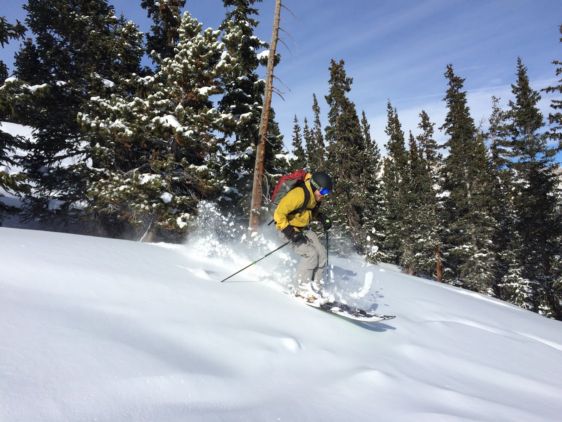
[caption id="attachment_22217" align="alignleft" width="584"] A friend enjoying the fresh powder [/caption]
Similar conditions to Thursday night will stick around for most of Christmas Day. A large cut-off storm to the West will be diving into the desert southwest throughout the day so the winds could quickly change. We could see our flow transition over to a West-Northwesterly direction on Friday so this may increase total snow amounts through Friday night. Northeasterly upslope winds will also move in on Friday night. This will bring light to moderate snowfall for areas along and east of the Eisenhower Tunnel so expect icy and somewhat snow-packed surfaces all the way down to Denver. In all, travel safe but enjoy the fresh snow and good company on Christmas Day! Wherever you are for Christmas, we hope that you will get a chance to enjoy all of this incredible new snow sometime over the holiday break! Merry Christmas Everyone!